Sole Piping
Sewerage & Water Supply Design Software
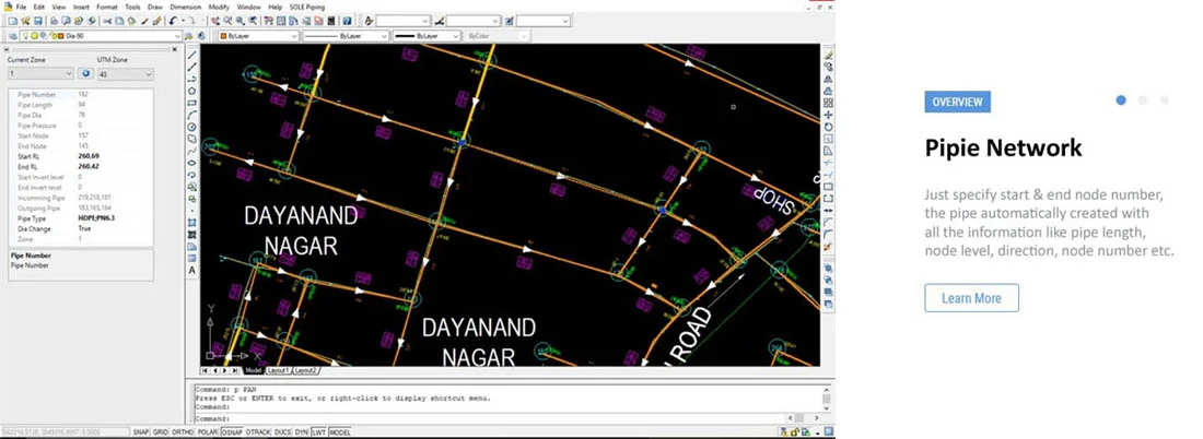
SOLE Piping is a comprehensive modeling software program for the design and analysis of sewer and water supply. It is the only software that has the capability to design both sewer & water supply in a signal package. Its intuitive interface makes it easier to create and edit networks quickly. SOLE Piping have inbuilt facility to work with satellite imagery from many provider like Google Earth, Bing Maps, OpenStreetMap, Yahoo Map, so we can directly work or present our project on the real world.
Sewer Design
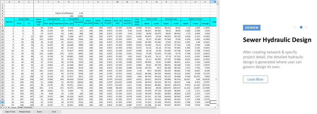
The interactive sewer design module is complete software to design sewerage network. The only requirement to design sewer network to specify nodes on the cad drawing and fill up some project parameter, the rest of the work automated by the software. SOLE Piping will calculate the invert levels, slopes and diameters of the pipes as well as the design flow, capacity and the flow velocity of each pipe. Although cad pipe structure & hydraulic design is automatically generated by the software, but user have all the tools to manage pipe structure & hydraulic design as per its project requirement.
Water Supply Design
Easy to use water supply design module, work with Loop & EPAnet to bring out best economical industry standard design in jiffy . Loop is static modeling software and EPAnet has dynamic modeling capabilities and water quality modeling software, so you can design any type of project as per requirement. User friendly commands to generate pipe structure with some clicks.
MAIN FEATURES
- Very easy & fast way to design pipe network
- Automatically calculate pipe size as per industry standard.
- Standard & user define pipe slope
- Calculate flow, capacity, velocity, flow depth & other parameter
- Automatically crown matched of pipe, in case of different size of pipe
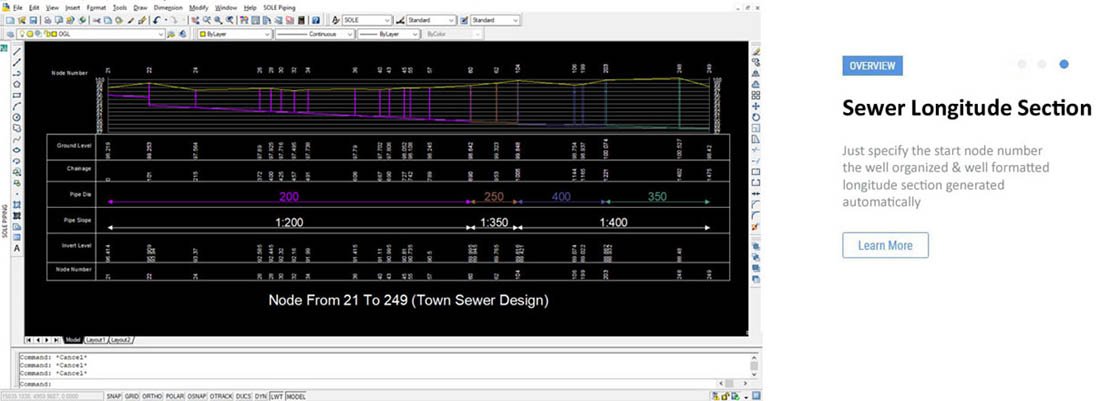
- Generate Detailed L–Section
- Automatically calculate pipe parameter & show it on the pipe
- Generate input file for Loop, Branch & EPANet.
- Read output from Loop, Branch & EPANet.
- Design structure automatically applied on cad drawing.
- Project can be compared or tested on Loop & EPANet.
- All the analytical report exported to excel.
- Draw smooth contour at user defines interval. The speed & smoothness are never before.
- Download large size georeferenced satellite imagery directly into your drawing.
- Works with satellite imagery from many providers like Google Earth, Bing Maps, OpenStreetMap, Yahoo Map and many more.
- Read Google earth elevation of specified area or objects.
- Import/Exxport Google KML file and cad drawing.
- Automatically generate DTM plan from your survey data.
- Grid base quantity calculation
Meet sole Piping. The ultimate software for Sewerage & Water Supply
The Ever growing Multi-Feature/Functional Software. Run with AutoCad for faster & smoother operation.


